Masterplan en Pinto
PROYECTO: Masterplan en Pinto
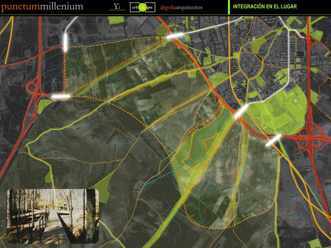
El territorio. Una ordenación respetuosa con el lugar y sus preexistencias identificativas.
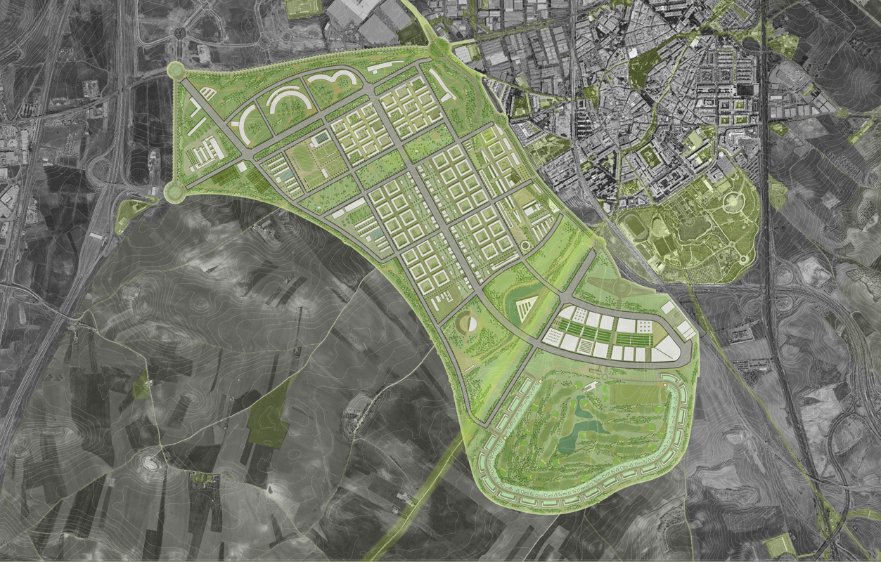
La topografía, la hidrología superficial, los hitos visuales, la percepción del paisaje circundante, los caminos rurales preexistentes son elementos y parámetros condicionantes de las determinaciones de la ordenación.
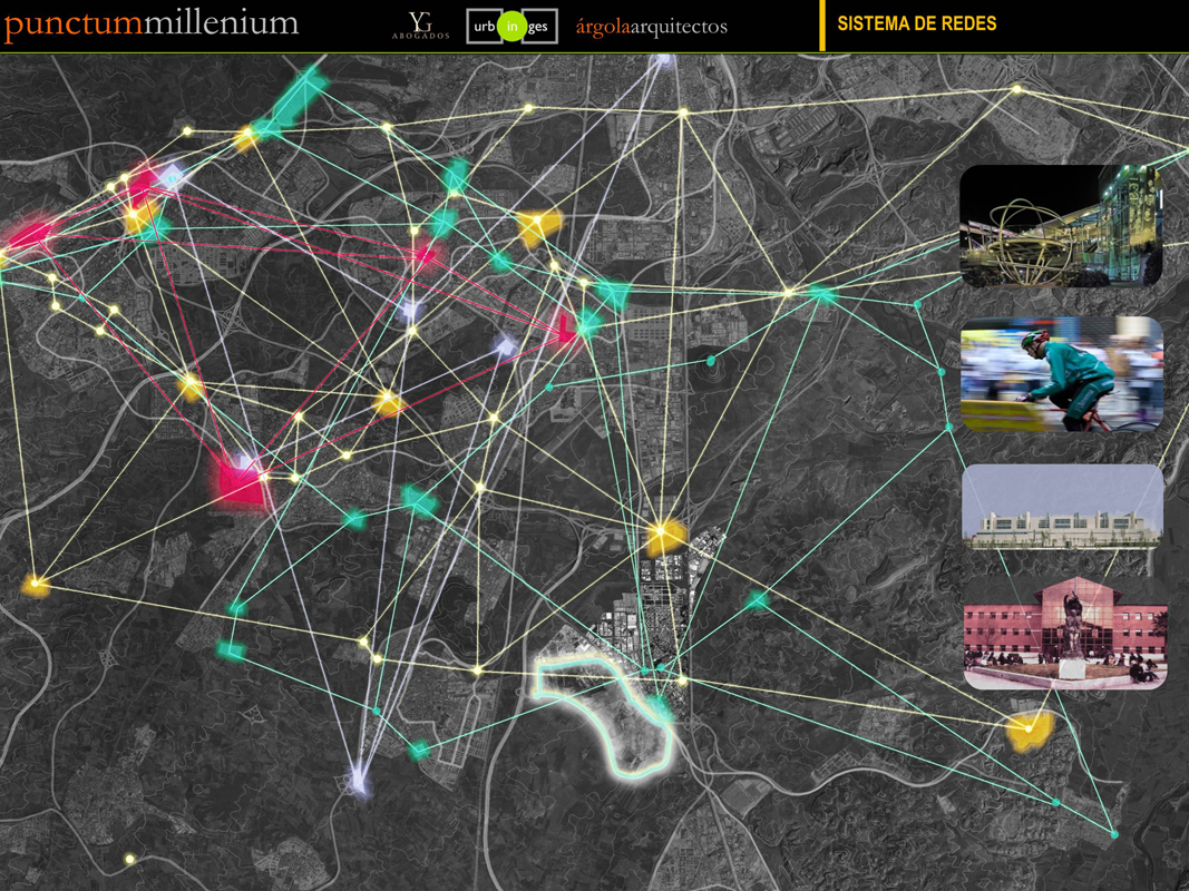
Refuerzo de la centralidad de Pinto en el contexto comarcal de Madrid – Sur
El desarrollo tranquilo, comparativamente más controlado en el RITMO, la INTENSIDAD, y en la mayor calidad de su PLANIFICACIÓN URBANA ha dado como resultado un hábitat residencial mejor que la media comarcal.
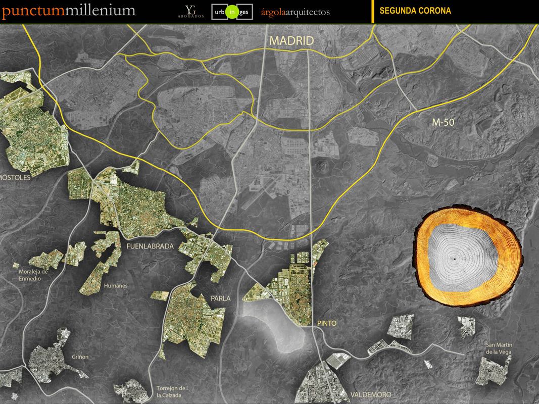
Pinto, situado en la segunda corona metropolitana, tiene ahora la posibilidad de recualificar el conjunto reclamando cuotas de centralidad que hoy corresponden sobre todo a los municipios de la primera corona metropolitana, de mayor tamaño, Getafe, Leganés y Alcorcón.
La estrategia para ello es la de diseñar un desarrollo urbano con una calidad claramente superior a las existentes en el ámbito metropolitano, incorporando usos singulares en el entorno, con el fin de convertir Punctum Millenium en un polo con gran poder de atracción.
El crecimiento como mejora de la ciudad existente. Una nueva centralidad.
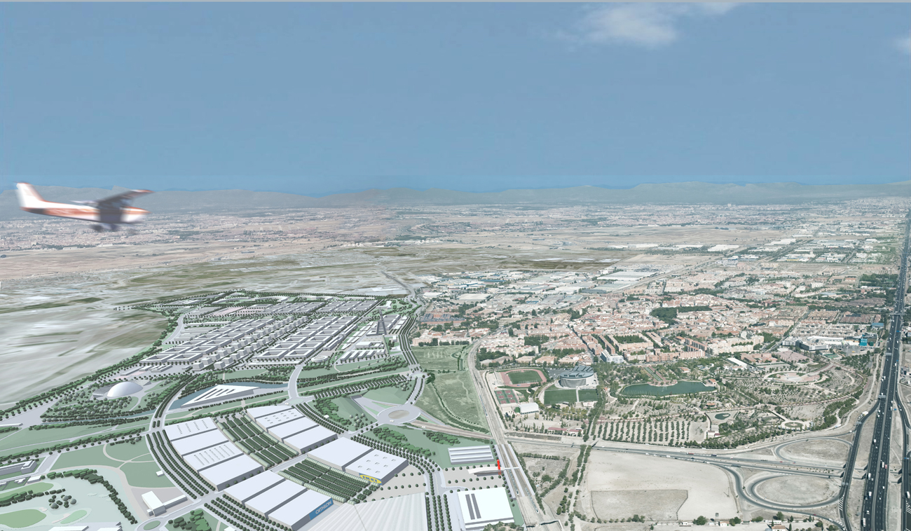
Se trataría de articular e integrar el nuevo desarrollo con la ciudad existente y no de yuxtaponer simplemente la nueva pieza como una ciudad independiente y separada.
Esa articulación e integración buscada, estará enfocada al incremento de la eficiencia urbana, es decir, a la disminución de la huella ecológica de la actuación y a la vez, al aumento de la complejidad urbana del conjunto.
Por tanto la propuesta de ordenación debe pretender la mayor y mejor integración con la ciudad existente. Para ello, el elemento básico de articulación que es el viario estructurante, completa y da continuidad al viario estructurante existente y al previsto en el Plan General, y siempre basándose en los elementos de intersección (rotondas) existentes y previstas en el planeamiento.
Además se debe tener en cuenta el objetivo de resolver las áreas de contacto de la nueva ordenación con la ciudad existente. En este sentido en la ordenación se considerará la creación de sinergias y valor añadido para las zonas urbanas colindantes.
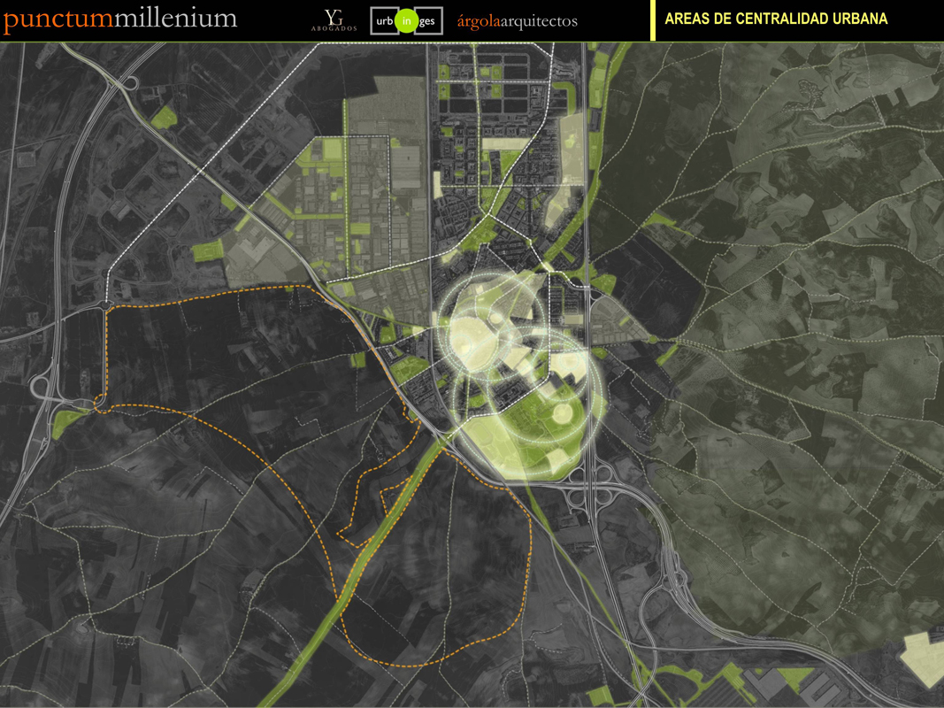
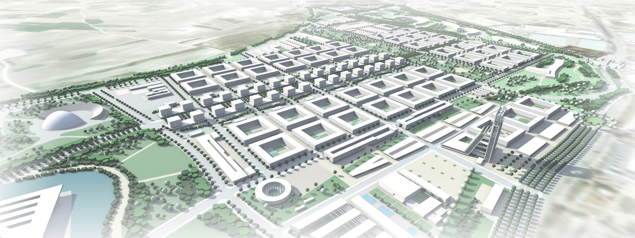
La propuesta establece una nueva área de centralidad Punctum Centro, en la zona de contacto y conexión con la ciudad existente.
Este modelo se caracteriza por:
Menor consumo de suelo.
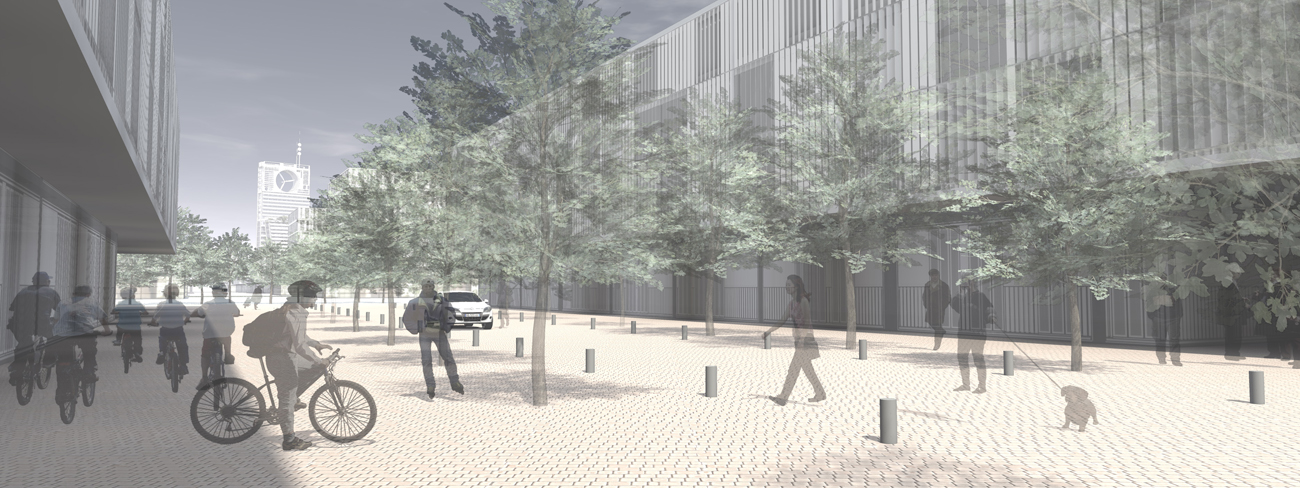
Espacios públicos destinados y diseñados no solo como corredores de transporte, soporte de la movilidad, sino como soporte de usos y funciones variadas y complejas como el juego, la fiesta, el mercado, el encuentro y la estancia….
Sus características de compacidad, densidad y complejidad funcional y social generan un mayor número de contactos potenciales por unidad de energía y tiempo consumidos en transporte. Facilita una mayor integración entre personas de rentas diferentes.
La complejidad urbana, un criterio básico para la planificación.
Aumentar la coexistencia y superposición de usos y funciones urbanas por unidad de superficie, aumenta la accesibilidad a la ciudad sin restricciones, sin excluir a personas dependientes para la movilidad (niños, mayores….)